WMO HydroHub Innovation Call - Pacific Island Countries: Project Concluded
The project titled "Non-contact measurement of river flows in the Pacific region, using innovative surface image velocimetry and stereoscopic methods" implemented by the National Institute of Water and Atmospheric Research (NIWA) of New Zealand in the context of the WMO HydroHub Innovation Call - Pacific Island Countries officially concluded in September 2023.

The project started in September 2022, with the main objective of enhancing water monitoring by operationalizing innovative solutions to address National Meteorological and Hydrological Services (NMHSs) hydrometric challenges. More specifically, it aimed at providing training on flow measurement using smartphones, Surface Velocity Radar (SVR), and camera stations, developing a stage-triggered stereoscopic camera station for flash floods, and deploying camera stations in Fiji to assess their effectiveness for Pacific rivers.
Training
The project has provided training on flow measurement with Surface Velocity Radar (SVR), smartphones, and trail cameras. A training workshop was held in Fiji for staff from Fiji Meteorological Service (FMS), the Pacific Community (SPC), and Water Authority Fiji. The training workshop included practical fieldwork measuring cross sections and surface velocities with SVR, deploying Ground Control Points (GCPs), trail cameras, stereoscopic camera stations, and recording imagery using phone cameras for surface velocimetry. The training workshop included classroom lectures covering background theory and practical deployment advice for SVR, surface image velocimetry, and stereoscopic camera stations. The training workshop also included data processing for SVR and imagery. A practical discharge calculator was developed and provided for use with SVR surface velocities and surveyed cross sections.
Participants were very enthusiastic, particularly with the surface velocity radar and the acquisition of the stereoscopic camera data. They were actively involved in operating the stereoscopic cameras and installing and running them.
Stereoscopic camera station development and installation
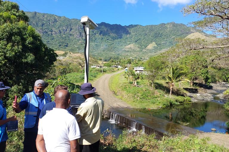
The project successfully developed stereoscopic camera stations for flood flow measurement. These stereoscopic camera stations are highly innovative, since they can be deployed without needing ground control points, and can be triggered from timelapse, water level (stage), or manually by local residents (citizen science).
Three stereoscopic camera stations were delivered to Fiji, with two installed in the headwaters of the RakiRaki catchment (Vatukacevaceva and Narara) at sites with water level recorders but no high flow measurements. The development of stage-discharge rating curves at these sites is important for the development of flood warnings for the downstream residents in RakiRaki where flooding is an ongoing problem. The third stereoscopic camera station was provided as a backup for these locations, or for installation by FMS and SPC at another site. Extra foundations were provided (9x) to enable stereoscopic camera stations to be deployed at other river sites. This means that the three stereoscopic camera stations can be used to capture flood events and generate stage-discharge relationships for many catchments and river sites throughout Fiji.

