
iClimateAction publishes three new reports on the climate observation data chain
Planning for extreme heat. Protecting mangroves from sea-level rise and salinity stress. Anticipating drought. Preparing for increasingly frequent and intense climate extremes.
These decisions may look very different, but they all depend on the same foundation: reliable observations of our changing climate.
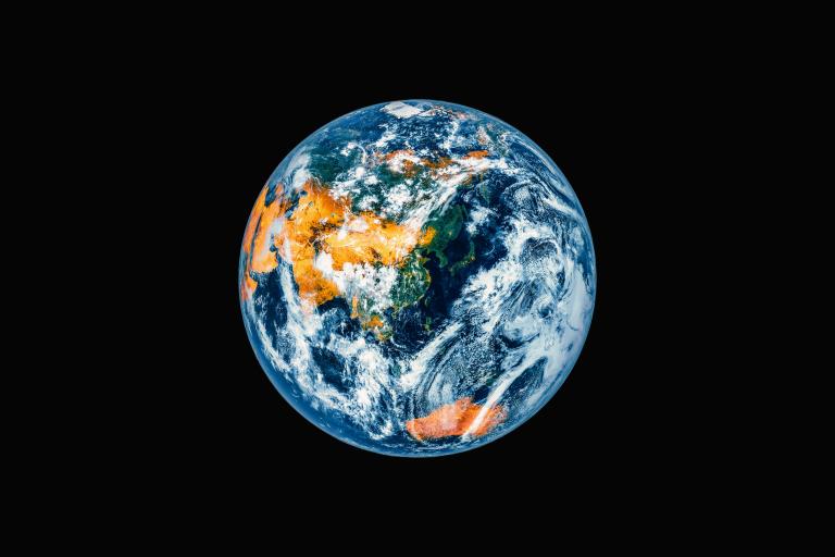
Today, those observations come from a combination of satellites orbiting hundreds of kilometres above the Earth and instruments operating on the ground, at sea and in the atmosphere. Together, they help monitor the 55 Essential Climate Variables (ECVs) identified by the Global Climate Observing System (GCOS) as critical for understanding how the climate is changing.
But how strong is that observation system? And just as importantly, how well does the information it produces meet the needs of the people using it?
Three new assessments (deliverables) carried out through iClimateAction by GCOS, WMO and GEO are helping answer those questions. Deliverable D2.1 examines the in-situ observation networks and data centres underpinning ECVs; D2.2 looks at the availability and exploitation of satellite observations; while D2.3 brings in the perspective of users trying to turn climate information into action. D2.1 and D2.2 also contribute to the forthcoming 2027 GCOS Status Report, a key periodic assessment that evaluates how well the Earth's climate is currently being monitored, highlights progress, and identifies critical gaps or deteriorations in global observing networks.
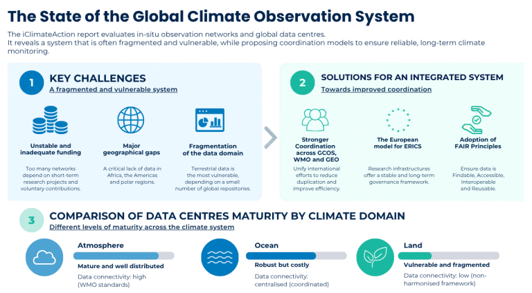
Deliverable D2.1 – Report on ECVs and related networks and data centers assesses the global in-situ observation system supporting ECVs.
Its findings show a mixed picture. Many networks continue to depend on short-term research projects, in-kind contributions or voluntary support, particularly in the ocean and terrestrial domains. Important geographical gaps also persist across Africa, South America, Southeast Asia, the Southern Ocean, polar regions and other remote areas.
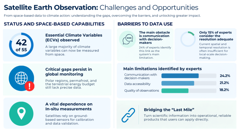
Yet these observations are indispensable. They are needed to calibrate and validate satellite measurements and to observe variables and environments that satellites cannot adequately capture, including beneath the ocean surface or within complex vegetation canopies.
The report also highlights key governance and sustainability challenges - and points to possible ways forward. In Europe, for example, structures such as European Research Infrastructure Consortia, or ERICs, offer one model for providing long-term governance, shared investment and open access to research infrastructure and data.
Deliverable D2.2 – Report on limitations for EO exploitation examines the space-based side of the system.
Satellites contribute observations to 42 of the 55 ECVs, providing repeated and near-global coverage for much of the climate system. But the report also shows that having good satellite data is not enough.
In a February 2026 survey of 33 climate experts, communication with decision-makers was the most frequently selected barrier to increased use of satellite observations, ahead of data accessibility and observation quality.
Other challenges span the entire data chain, from processing capacity and interoperability to spatial and temporal resolution and the availability of in-situ observations.
Deliverable D2.3 – Report on user perspectives on ECV suitability, currently an interim assessment, looks at the system from the other end of the chain: the people trying to use climate information in practice.
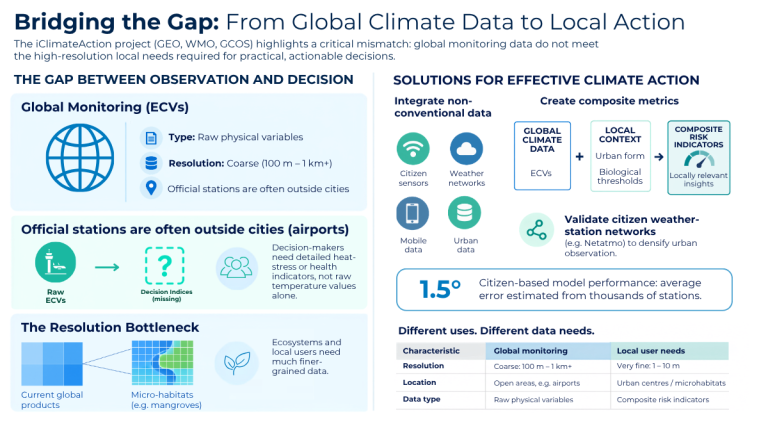
Findings from iClimateAction’s Urban Heat and Nature/Ecosystems demonstrators show that global observations do not always translate directly into information that supports local decisions.
Urban heat practitioners, for example, often need information at neighbourhood or even street level. In the Maldives, global datasets can provide a useful first assessment of risks to ecosystems such as mangroves, but local decisions may still require finer detailed field measurements and ecosystem-specific information.
Taken together, the three reports point to a common conclusion: strengthening climate action requires more than producing additional and better observations.
It also requires sustained investment in in-situ networks, stronger integration between satellite and ground-based systems, better data management and interoperability, and closer collaboration between data providers and users.
Above all, it means investing in the often-neglected “last mile”: translating reliable scientific observations into information that is relevant, trustable, understandable and actionable for decision-makers.
This is where stronger collaboration between WMO, GCOS and GEO through iClimateAction can help connect the different parts of the climate information chain, from observation to action.
iClimateAction is a Horizon Europe project bringing GEO, WMO and GCOS together to strengthen the Essential Climate Variables data chain from science to services. For more information, visit the iClimateAction website.