Forecast of good rains for Greater Horn of Africa coupled with caution
A new seasonal forecast for the drought-stricken Horn of Africa shows higher chances of a strong rainy season in many parts of the region. But this is coupled with caution and warnings that stakeholders should still prepare for “worst case scenarios.”
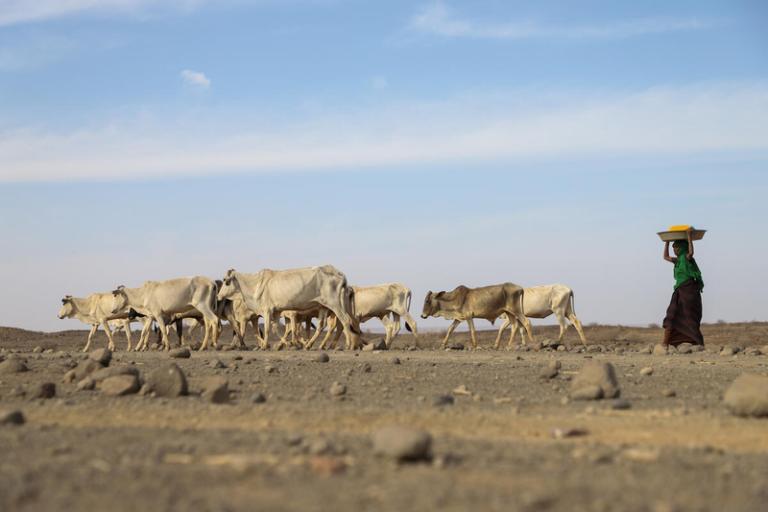
A new seasonal forecast for the drought-stricken Horn of Africa shows higher chances of a strong rainy season in many parts of the region. But this is coupled with caution and warnings that stakeholders should still prepare for “worst case scenarios.”
The March to May season constitutes an important rainfall season, particularly in the equatorial parts of the region where it contributes up to 70% of the total annual rainfall. A renewed failure of the rains would have massive socio-economic consequences after two years of persistent drought which has already decimated livestock and agriculture and undermined health and well-being in one of the world’s most fragile regions. An estimated 12-14 million people are classed as severely food insecure in Ethiopia, Kenya and Somalia.
Against this background, the Greater Horn of Africa Climate Outlook Forum (GHACOF) brought together meteorological services and climate scientists, governmental and non-governmental organizations, decision-makers in climate-sensitive sectors and civil society representatives to discuss likely impacts and how to cope with the looming humanitarian crisis.
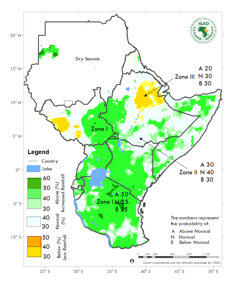
Southern to central parts of the region have the highest chances of receiving more rain than normally at this time of year, particularly southern, central and northern Tanzania, eastern Uganda, northern Burundi, eastern Rwanda, southern and western Kenya, eastern South Sudan, western Ethiopia, a few localities in southern and south-eastern Ethiopia, and southern and northern Somalia, according to the outlook.
However, western South Sudan, and central and north-eastern Ethiopia are likely to receive less rain than usual. ICPAC also estimates that higher than normal temperatures could be recorded in southern Tanzania, most of Kenya, Ethiopia, Djibouti, Eritrea, and northern Sudan.
Seasonal skill
The seasonal outlook forum, known as GHACOF60, was convened by IGAD’S Climate Prediction and Applications Centre (ICPAC), which is a WMO designated Regional Climate Centre. Its seasonal forecast is based on an analysis of several global climate model predictions customized for East Africa.
However, it is important to note that global climate models’ forecasts have relatively low skill in March April May season. This is largely a consequence of the association between rainfall and teleconnections such as the El Niño Southern Oscillation and the Indian Ocean Dipole are weak at this time of year.
“Given that we have experienced below average rainfall in the past three seasons, a wetter than normal season doesn’t mean that the region will immediately recover from the impacts of drought, especially in the eastern parts of the Horn. This is why I urge all to consult our weekly and monthly forecasts as they have a much higher degree of predictability," said Dr Guleid Artan, ICPAC Director.
In the regions worst hit by drought, the current trends are comparable to those observed during the 2010-2011 famine and 2016-2017 drought emergency.
ICPAC’s Drought Situation Updates will closely monitor the evolving situation and the season's performance. However, considering the high livestock offtake and deaths reported so far and that the next harvests start around August, it is worth noting that any positive impacts will be realized much later.
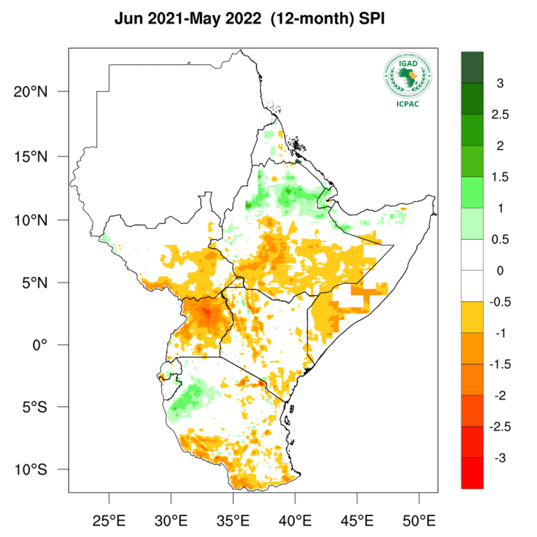
The seasonal outlook covers relatively large areas. Local and month-to-month variations might occur as the season progresses. Spells of heavy rain and above normal rainfall may occur in areas with an increased likelihood of below normal seasonal totals and vice versa. ICPAC will provide regional updates on a regular basis while the National Meteorological and Hydrological Services (NMHSs) will provide detailed national and sub national climate updates.
WMO supports regional climate outlook forums around the world, providing actionable climate information, for the forthcoming season, leveraging on inputs from global and regional producing centres and National Meteorological and Hydrological Services. Improved seasonal forecasts are pivotal to help plan ahead in climate sensitive sectors like agriculture, food security, health and disaster risk reduction.
Humanitarian Assistance
WMO is stepping up its capacity to provide tailored support to the humanitarian sector. This includes offering support to facilitate access the most appropriate data, services and expertise from the WMO community to improve the development, design and operation of weather and climate forecast triggers.
IGAD’s Executive Secretary, Dr Workneh Gebeyehu, stated that beyond immediate humanitarian assistance, “there is urgent need for regional and international cooperation to support national efforts to build community resilience through investing in sustainable development as the most effective approach to managing recurrent drought.”
“In view of these grim realities, IGAD renews its call for an immediate scaling-up of humanitarian and risk reduction efforts, primarily by the respective national governments, humanitarian actors, and development partners. Humanitarian actors are also called to advocate for no-regret interventions. Lastly, IGAD urges governments of Member States to step-up investments in drought resilience-enhancing interventions and adopt innovative drought risk management approaches including activation of a forecast based anticipatory actions,” the statement said.


